.png)

About Us
About Satellite Imaging Corporation
Satellite Imaging Corporation (SIC) specializes in international satellite imaging collections, global image processing, and producing seamless orthorectified mosaics, 3D Digital Elevation Models (DEMs), and 3D Digital Terrain Models (DTM) for worldwide industries using CAD and GIS applications utilizing mono and stereo satellite map data.
Consultancy
Ongoing remote sensing, geodetic, and GIS mapping consultancy services are provided to our global clients, including the set-up of reliable source coordinate databases in support of computerized mapping, international exploration, and development of projects around the world and to clients implementing global GIS Projects, utilizing a variety of source data, referenced to international survey datums and mapping projections.


Image of the Day
Climate Change – Urban Flood Risk Management
Click no the image to view the animation with flooding conditions.
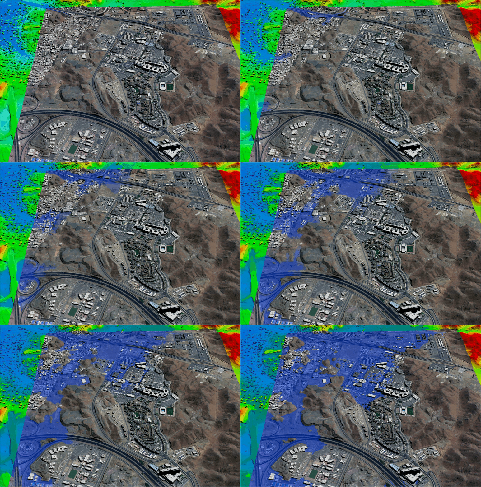
King Abdulaziz Medical City – Jeddah, Saudi Arabia – Copyright – 21AT
Animation produced from Tri-Stereo 30cm Satellite Imagery and 50cm HDTM with breaklines are used for hydrological modeling to support urban Flood Risk Management (FRM). Due to climate change, the 50cm HDTM supports hydrological modeling, flood forecasting, and management to identify areas susceptible to flooding and support an early warning system. High-Definition HD15cm satellite imagery is available for FRM and other applications.
Applications
Satellite Imaging Corporation

Mining
WorldView-3 Short Wave InfraRed (SWIR) with 8 spectral bands, and a spatial resolution of 3.7m, is one of the best Satellite sensors for geological interpretation, supporting mineral mapping to allow geologists and researchers to collect reflectance data and absorption properties of soils, roc...
Oil and Gas
Satellite remote sensing applications have been supporting the Oil & Gas industry since the first optical satellite, obtaining information of earth land-cover, was launched in 1972. By utilizing spectral data, valuable terrain data became available for geological interpretation to plan the location of...
Geographic Information Systems
Satellite Imaging Corporation (SIC) has developed comprehensive policy and procedures to include QA and QC in the planning stage of every project involving the use of satellite, aerial, and UAV remote sensing data for GIS...

Standard Stereo Versus Tri-stereo
It’s important to emphasize that these Satellite sensors can acquire standard Stereo (2 scenes) or Tri-Stereo (3 scenes) satellite imagery to produce high-resolution 50cm 3D Digital Elevation Models (DEMs):
Why Choose
Satellite Imaging Corporation
That SIC has decades of global experience (founded 2001). Crunchbase
Their mission: to provide global geospatial intelligence via satellite imagery.
Mention of international technical capability: DEMs, orthorectification, GIS integration.